
Leicestershire Newspapers’ ‘Casualty Notices’ Index
The Leicestershire Newspaper ‘Casualty Notice’ Index, was not an intended mapping project at that time. I had attended a Leicester Heritage Fair at the Adult Education Centre. Put on by John and Tina of the Document Media Centre two or three times a year. There I met Joan, a local Aylestone Historian. Joan has published a few books relating to Aylestone; amongst other research. One task she had set her self, to aid swift research, is to create an Index of all the instances of ‘Casualty Notices’ in the Leicestershire newspapers. After our first meeting, Joan had kindly offered and provided her full casualty index.
The original Excel data needed quite a bit of cleaning and standardising; for it to be used effectively. This is not a reflection on the work produced by Joan. It does, however, highlight the difficulties in data management and standardisation, from its conception to possible uses. Data Analysts and Managers have to be aware of the limitations of date, where it has come from and how it can be used, etc.
Records
Once cleaned and purged, to a level useable for my requirements, the Database amounted to
- 9052 Total Records covering the whole of Leicestershire
- 590 Records that are, currently, non spatially referenced
- 2570 Records that pertain to men who have their town of residence listed
- 5892 Records that pertain to men who have a street in Leicester listed
Newspapers
There were 4 Newspapers accessed, that included :
- Leicester Mercury
- Daily Post
- Illustrated Chronicle
- Leicester Mail
Data included
She vigilantly went through all copies of each newspaper consulted, for the War period and noted the basic detail; listed below.
- SURNAME
- Forenames and or initials
- Awards
- Rank
- Regiment
- Street Names, some with numbers
- Town, if no Street
- Reason for ‘Notice’
- Paper
- Date
- Page
- Notes
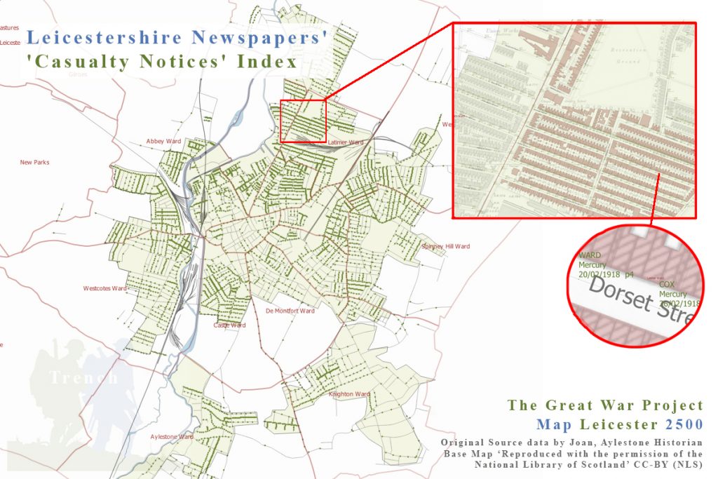
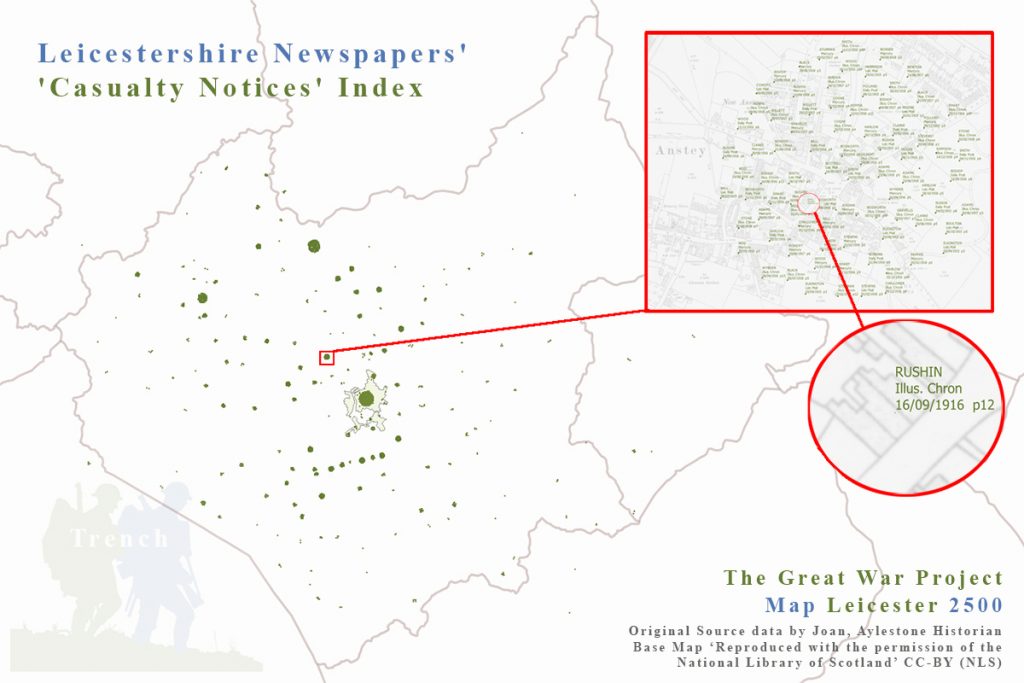
With either a Town or Street Name given within the index, it automatically gave the data a Spatial Reference. A little work was done on the data, in Quantum GIS, or QGIS, a free and open source Geographical Information System. Or simply a tool for mapping and analysing data that is spatially referenced to the Earth. The first image above illustrates the times when a man was listed alongside his town of residence and the second one adjacent illustrates the 5892 listings on the streets of Leicester.
A point to be made here, is that a man could be noted in the papers multiple times; either in the same paper or one of the other three. It is here where I should promote and quote the ‘Trench’ Project Mission… A Social History Initiative for Local Communities to engage, encourage & to share family, social & military history. Discover & map together.
What a benefit it would be, to have indexes of this nature, for all regions of the Country.
As ever, your help, encouragement and engagement, at this time, would be very much appreciated! A click, a like, an engagement in conversation or sharing, help me to improve my social presence; and if you can add a little to the crowdfund, then that would also be great.
Thank you for reading this Blog, that itself is very much appreciated.
Contacts
Joan the Aylstone Historian – No Known social media
The Document Media Centre (Link aware), but can be found at doc-media-centre.org
X – @DocMediaCentre